Background

Traditional Neighborhood (T) Zoning Districts are widely used throughout Saint Paul, especially along transit corridors and at major intersections. First adopted in 2004, the four T Districts are intended to foster compact, higher density, walkable neighborhoods with a compatible mix of commercial and residential uses.

The T Districts allow flexibility for mixed land uses and include development and design standards to create pedestrian-oriented places. Amendments and rezonings to T2, T3, and T4 districts occurred in 2011 as part of a Zoning Study of the Central Corridor along University Avenue.
The 2040 Comprehensive Plan supports new affordable housing and compact, pedestrian-friendly, mixed-use development with flexibility to respond to changing conditions and opportunities. The proposed amendments to the Zoning Code offer an opportunity to better align the four T Districts with Comprehensive Plan goals and policies, consistent with the Comprehensive Plan’s implementation chapter and Minnesota State Law. Both call for the Zoning Code to align with the Comprehensive Plan.

Study Area

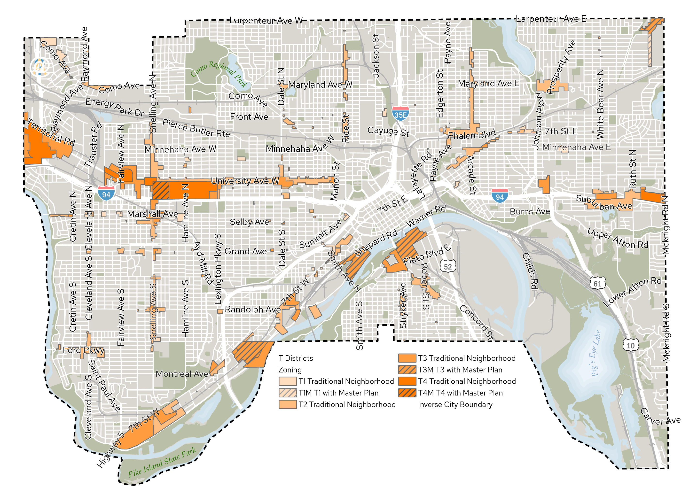
The T Districts are highlighted in orange on the map. For more details and information, view the Zoning Map.

T Districts Study Area Map

Timeline

  • Spring – Summer 2022
    • Initiation
    • Background research
    • Initial outreach
       
  • Fall 2022 – Summer 2024
    • Ongoing preparation of draft text amendments
       
  • Fall 2024 – Winter 2025
    • Planning Commission public review and hearing
    • District Council workshop
    • Business Review Council outreach
       
  • Spring 2025
    • City Council public review and hearing
    • City Council adoption

Last Edited: September 18, 2024